Original maps are available at Map available at : http://data.aad.gov.au/aadc/mapcat/
 |
| Australian Antarctic Territory. Windmill Islands. Wilkes Land. Antarctica. Edition 1. Produced by the Australian Antarctic Data Centre. Published November 2013. Map Number 14238 |
 |
| Windmill Islands. Wilkes Land. Antarctica. Satellite Image Map 1:50000. Published December 1995 by the Australian Survey and Land Information Group for the Australian Antarctic Division Map number 95/056 |
 |
| Windmill Islands. Map 1 of 5. Edition 6. Produced by the Australian Antarctic Data Centre. Published August 2012. Map Catalogue Number 14110 |
 |
| Windmill Islands. Map 2 of 5. Edition 6. Produced by the Australian Antarctic Data Centre. Published August 2012. Map Catalogue Number 14111 |
 |
| Windmill Islands. Map 3 of 5. Edition 6. Produced by the Australian Antarctic Data Centre. Published August 2012. Map Catalogue Number 14112 |
 |
| Windmill Islands. Map 4 of 5. Edition 6. Produced by the Australian Antarctic Data Centre. Published August 2012. Map Catalogue Number 14113 |
 |
| Windmill Islands. Map 5 of 5. Edition 6. Produced by the Australian Antarctic Data Centre. Published August 2012. Map Catalogue Number 14114 |
 |
| Casey. Local Area North. Produced by the Australian Antarctic Data Centre. Published December 2011. Map Catalogue Number 14008 |
 |
| Casey Station. Wilkes Land. Antarctica. Orthophoto Map. Edition 1 Published August 2002 for the AAD by DataVison GIS Pty Ltd |
 |
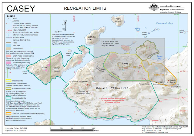
| Casey. Recreation Limits. Produced by the Australian Antarctic Data Centre. Published August 2014. Map Catalogue Number 14295 |
 |
| Casey. Station Limits. Produced by the Australian Antarctic Data Centre. Published August 2014. Map Catalogue Number 14294 |
 |
| Vincennes Bay. Wilkes Land. Australian Antarctic Territory. Produced by the Division of National Mapping, Department of National Development. Canberra, Australia. 1963. |